Wednesday, August 4, 2010
land formations
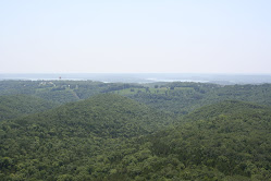
When one is driving across the USA, one pays attention to the divergent landscape. After the Great Plains of Iowa and parts of Nebraska and Wyoming, mountains are quite interesting. Of course, there's the patches of snow on the peaks above 10,000 feet, but along I-80, some of the most interesting formations are raised platforms of rock and sand. I have learned that the largest of these is a plateau - an area that is above the adjacent terrain on at least one side; similar is the mesa - from the Spanish for "table", it too is a flat raised area, but it is toyally surounded by lower terrain. Finally, the smallest of these is a butte - which one dictinary says is an "eroded mesa". but can be seen as a smaller version. Completely eroded buttes often result in hoodoos - tall spire like formations. Descending from the mountains into the basin of Utah, one encounters the salt flats - a flat section of land that is covered with salt from evaporated water (aren't you glad you asked?) We drove passed the most famous of these - the Bonneville Salt Flats, a section of which is used to speed test cars. The speed limit on the highway near there is 75 mph, although most folks go a bit faster. A favorite practice of the locals is to take dark rocks and stones arrranged on the white salt to make formations like hearts (better than carving on a beech tree I think) or initials or messages like "peace" or "Go Vikings" (I don't think they mean the ancient Danes, probably a local sports team).
Subscribe to:
Post Comments (Atom)


No comments:
Post a Comment